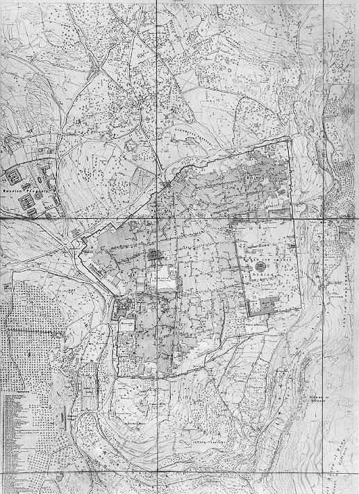
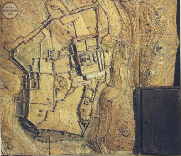
One of the finest maps made in the nineteenth century was a map drawn
by a British Soldier, Captain C. Wilson, in the year 1864-1865. Wilson created
two maps. The first is a map of the Old City (scale 1:2500) and the second
of Jerusalem's surrounding (scale 1:100000). These maps were the basis to
all others made later, until the First World War when Jerusalem was photographed
from the air.
The Temple Mount in 1864, scanned detail map from the above map. (1.4 Mb)
Wilson's survey, detail of the Dome of the Rock Base (400k)
Photograph of the Platform from the Northeast, 1865 (300k)
Map of the Underground Features of the Temple Mount (300k)
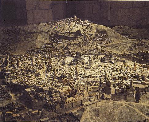
Conard Schich, a famous Architect who lived in Jerusalem at the end of
the nineteenth century, created a three dimentional model of Jerusalem as
he envisaged it to be during the period of the Second Temple. The size of
this model is 99 by 85 cm, and its scale 1:2500.
A three dimentional map of Jerusalem was made in the year 1873 by an
Hungarian priest who lived in Jerusalem for twelve years. This three dimentional
map was displayed in an exhibition in Viena in the year 1873 and later in
several countries in Europe. The size of this map is four by four and a
half meters, and its scale is 1:500. It represents the Old City of Jerusalem
and its surroundings.
Updated July 24, 1996, October 21, 1996.